Identify resources that have stopped at a certain site or area.Determine when vehicles stop within a tagged area and how long they’ve stopped for. This is useful for keeping track of the number of hours spent at a job site or at a supplier.
A map tag is a point of interest placed on a map. Once placed, reports can be run to determine which vehicle visited and how long it was stopped within that zone.
The Map Tag can provide past stops information. i.e. stops before the Map Tag was placed on the map.
Creating a Map Tag | |
|---|---|
Log into the Smartrak Map site (NZ or AU) Navigate to Add a Map Tag 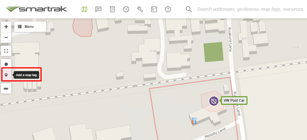
2. |  |
Select the location on the map that you wish to tag or right click on that location with your mouse  | 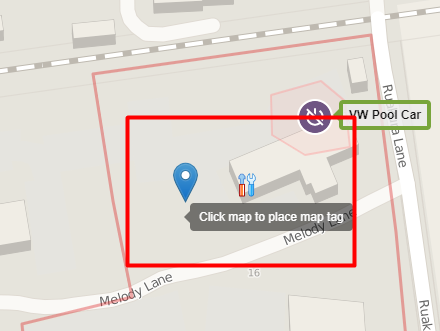 |
3. Name the map tag 4. Record and record any important details about the map tag 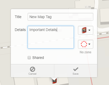 |  |
5. Select a desired icon for the map tag 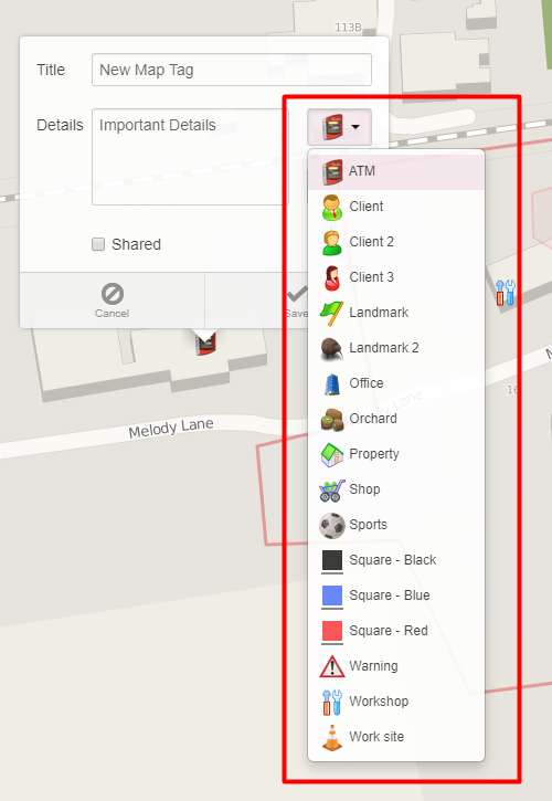 |  |
6. Select the appropriate radius (this is very important as when it comes time to report on this map tag, this radius must include where a vehicle would stop if at this location) 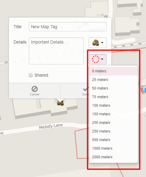 |  |
7. Select Shared to share within organisation 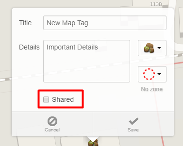 |  |
8. Save |  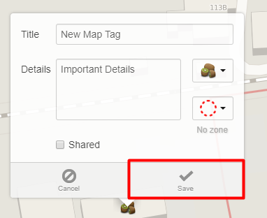 |
Reporting Once the map tag has been created, reporting on this map tag can be undertaken retrospectively. Data is onlyavailable from the date that the AVL units are installed in any vehicles beingreferenced in the report, or 913 days, whichever is shorter. The Map Tag Zone Report provides information on whenever a vehicle has stopped within a map tag zone for more than 2 minutes. See below for reported information. |  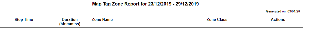 |
If you are unable to find an answer to your question in here please log a support request via the Smartrak Service Desk | |
Map User | Self Help | Service Desk | Knowledge Base | Trouble shooting | Smartrak Portfolios